29 Ancient Maps That Show How Our Ancestors Saw The World
Title : 29 Ancient Maps That Show How Our Ancestors Saw The World
Link : 29 Ancient Maps That Show How Our Ancestors Saw The World
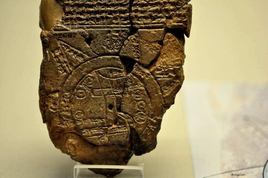
The oldest known world map was made in Babylon in the 6th century BC.
The map shows Babylon in the center of a world that extends no further than the edges of Mesopotamia. Around the world is a round "bitter river." The seven points beyond the river are islands that cannot, they believed, be reached.
These ancient world maps might be inaccurate, but they were once thought to be exemplars of cartography.
When Earth's first people looked out around them, they couldn’t imagine how far the scope of the world extended beyond what stretched out before their own eyes. Their world was the land that surrounded and fed them, and as far as they knew, it extended no further.
Eventually, the earliest human civilizations tried to measure the extent of the world and made maps that showed what, to them, was the whole world.
The first of these ancient world maps was reportedly made in Babylon more than 2,500 years ago. It shows a world that extends little past their own empire, surrounded by bitter waters and pointed islands on which they believed no man could survive.
Those waters surrounded most of the extant ancient world maps. The world, to them, was a round disc surrounded by an ocean, and a place consisting only of Africa, Europe, and Asia.
As time passed, maps slowly grew larger as humans' knowledge of what lay outside of the Mediterranean grew. The northern parts of Europe were fleshed out, Britain was discovered, and, in time, little markings were made south of Egypt warning that no person could survive beyond this point.
These ancient world maps also became more and more accurate — until Christian theologians started insisting that the world was perfectly divided in the shape of a T, centered around Jerusalem. Under such influence, ancient world maps started showing an idealized vision of the real world, charted by Biblical events and often including places like the Garden of Eden and Magog as actual locations in the real world.
With the dawn of the age of exploration in the 15th century, though, our concept of the world started to open up once more. Slowly, world maps started fleshing out the east to include China, Mongolia, Korea, and Japan. And, at the same time, Chinese explorers extended their world maps, expanding the tiny space they'd once given to Europe into the large continent they now knew it to be.
Soon, the first globe was made the year before Christopher Columbusreturned from the New World. It showed the world as a sphere, with a great, empty ocean where the Americas would soon be discovered.
When Columbus returned, world maps started to take the shape we know today. The Americas were slowly charted, Australia and New Zealand began to appear, and explorers slowly revealed the world in its full scope.
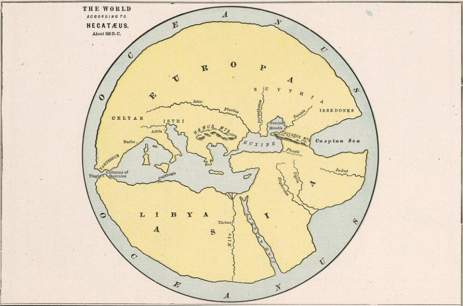
Hecataeus of Miletus' map of the world, made in the 5th or 6th century BC.
Hecataeus divides the world into three parts: Europe, Asia, and Libya, centered around the Mediterranean Sea. His world is a round disc surrounded by an ocean.
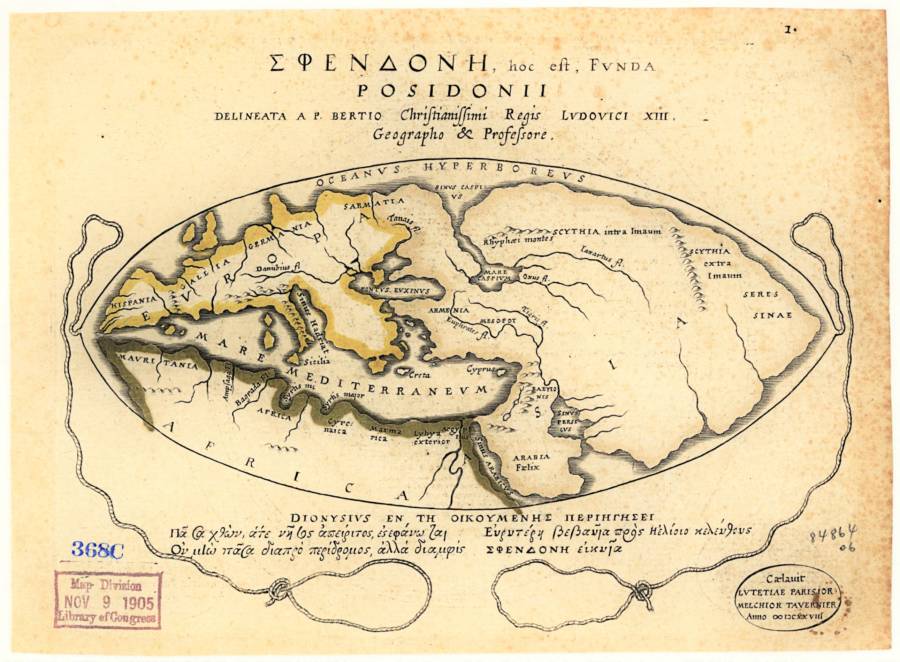
Posidonius' world map, made in the 2nd century BC.
This map expands on the early Greek vision of the world, including discoveries of Alexander the Great.
Pomponius' world map, made in 43 AD.
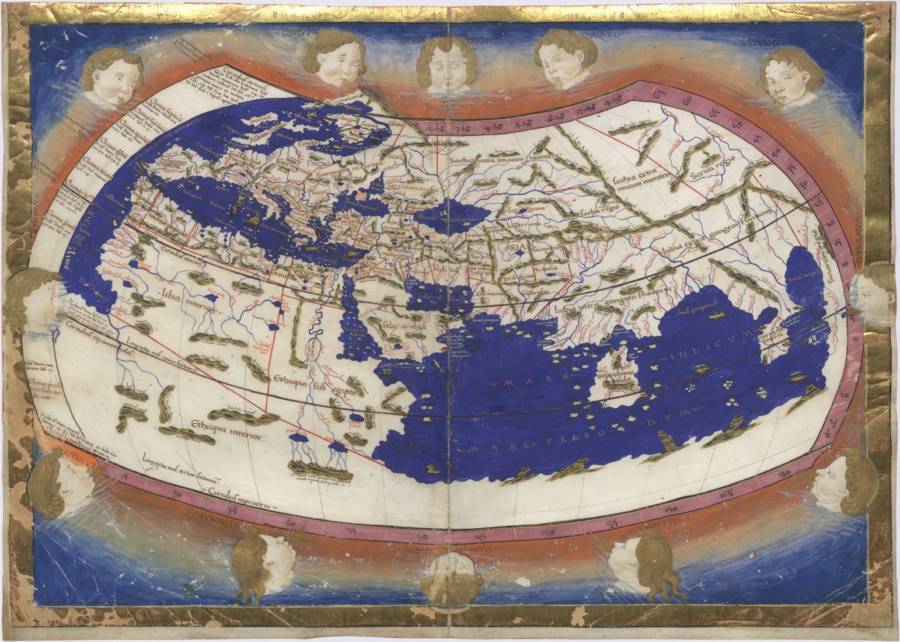
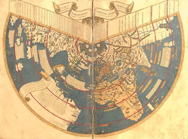
Ptolemy's world map, designed in 150 AD.
Ptolemy was the first to add longitudinal and latitudinal lines to his map in the world.
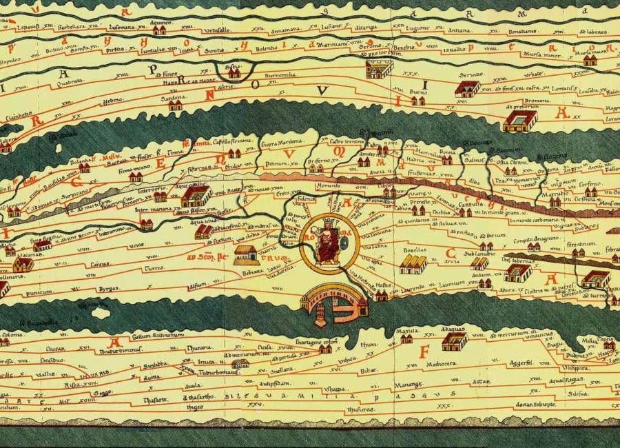
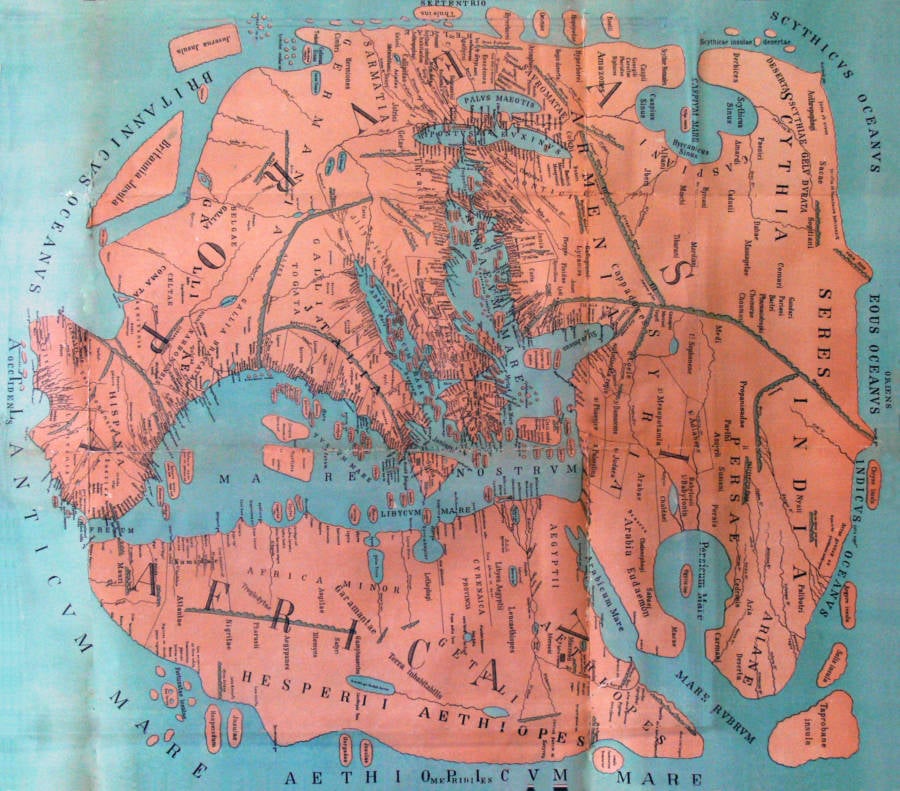
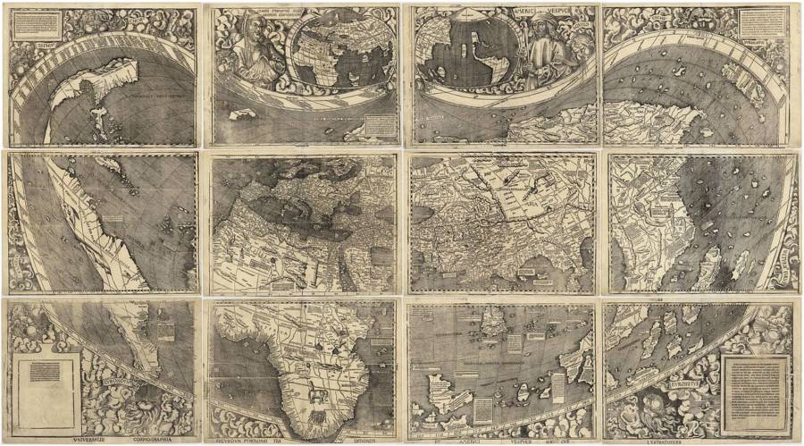
The center of the Tabula Peutingeriana, a 4th century Roman map outlining the road network of the Roman Empire.
The full map is extremely long, extending from Iberia to India, with Rome as the center of the world.
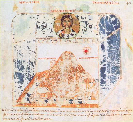
Cosmas Indicopleustes's model of the world, from Christian Topography. 6th century AD.
Cosmas showed the world as a flat place, with the sky overhead shaped like a chest and heaven watching over it all.

Cosmas Indicopleustes' world map, from the 6th century, depicting the world as a flat rectangle.

A fanciful rendition of the "T and O" map developed by Isidor of Sevilla in the 7th century.
These maps divided the world into three, perfectly divided parts: Asia, Europe, and Africa, with Jerusalem at the center of the world.
This version of the map was drawn by Jean Mansel between 1459-1463.

A later Christian map, the Bunting Clover Leaf Map, drawn by Heinrich Bunting in Germany in 1581.
This map is not meant to depict the world as it is, but instead the world as an extension of the Christian trinity, with Jerusalem as the center that holds the world together.
The Anglo-Saxon Cotton Map, created between 1025 and 1050 AD.
The eastern parts of the world make the topmost part of this map. The artist has painted every river in Africa red, misunderstanding descriptions of the Red Sea.
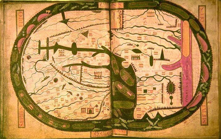
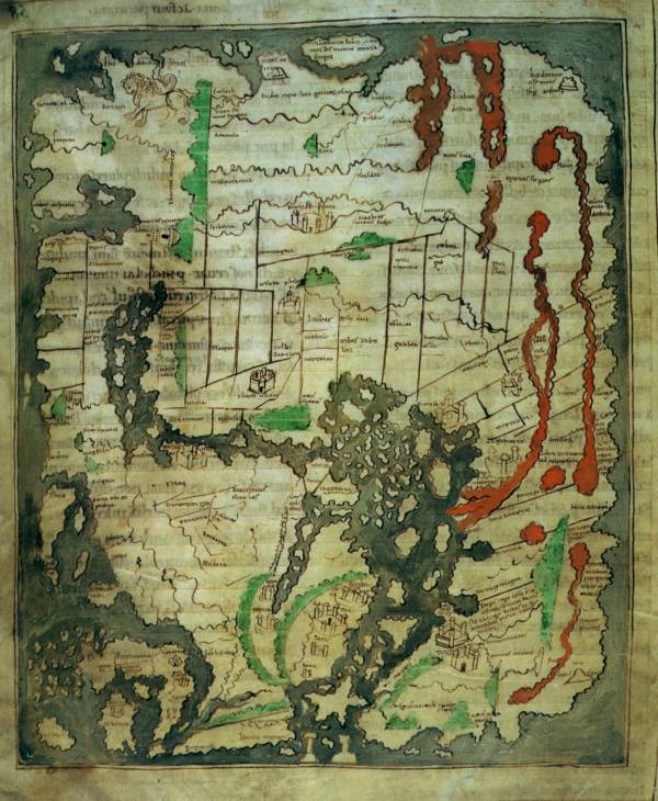
The world according to Beatus of Libeana, and Asturian monk, created in the 8th century AD.
Beatus's map is called a "Christian Map," based on the T and O design.
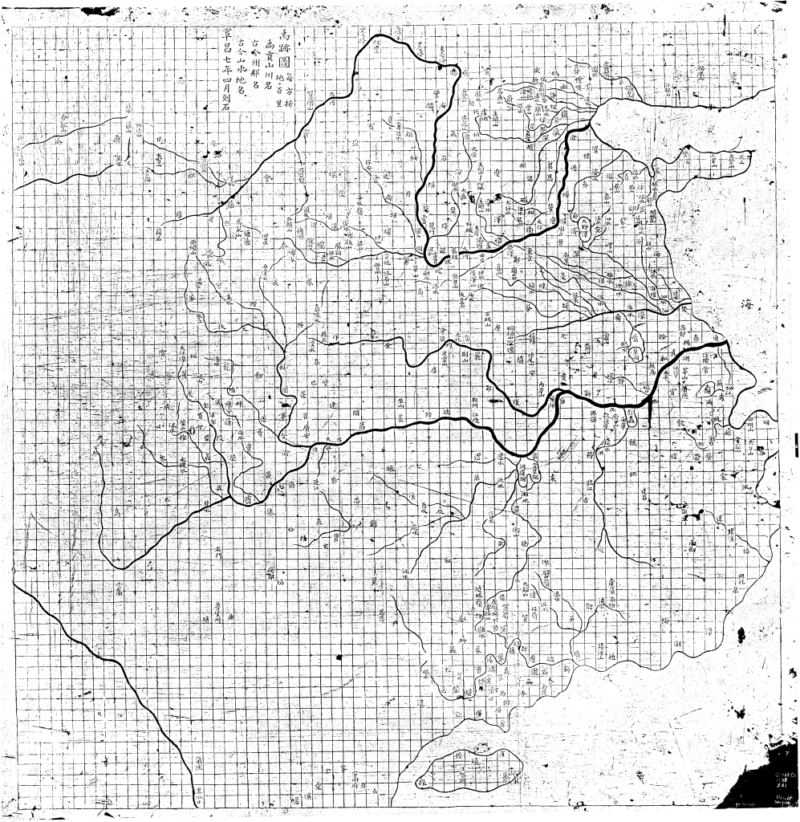
The "Map of the Track of Yu Gong" was carved into a stone in Shaanxi, China, in 1137.
This map, depicting the scope of the Chinese empire, was meticulously drawn on a rectangular grid.

Mahmud al-Kashgari's map of the world, drawn in the 11th century.
This map centers the world around Balasagun, an ancient city in the place where Krygyzstan now stands. It includes places prophesied to appear in the end times, like Gog and Magog.

Al-Idrisi's Tabula Rogeriana, drawn in 1154 AD.
This map was created based on the reports of Arab merchants who had travelled across the world. It was, at the time, the most accurate and extensive map of the world.
Though the map depicts Europe and Asia extensively, it still only shows the northern parts of Africa.

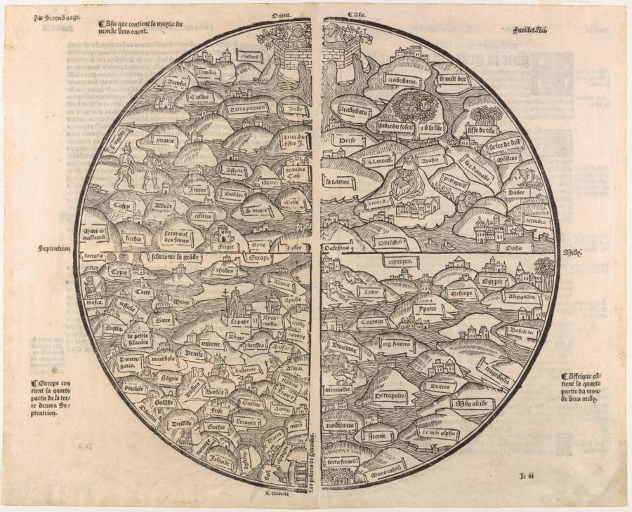
The Psalter World Map, drawn by an unknown medieval monk in 1260 AD.
Maps from this period often put the east at the top of the world, as the place where the sun rises, with Jesus watching over the world.
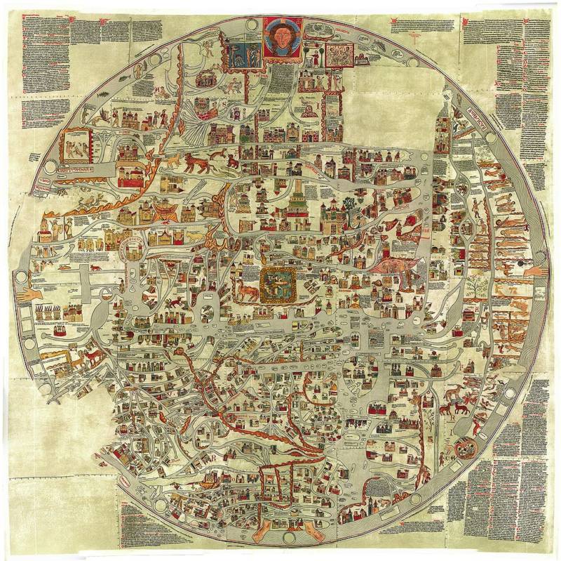
Gervase of Ebstorf's world map, drawn in Germany in the 13th century.
The Ebstorf Map is based on the medieval T and O model, with Jerusalem at the center of the world. It is decorated with illustrations from Biblical stories for each part of the world.

The Hereford Mappa Mundi, drawn by Richard of Haldingham in the 14th century.
This is another T and O map, with Jerusalem at the center at the east at the top. The circle at the far south side of the map is the Garden of Eden.
Italian geographer Pietro Vesconte's world map, drawn in 1321 AD.
Vesconte, using nautical charts to map the seas, brought accuracy back into maps after centuries of T and O designs.
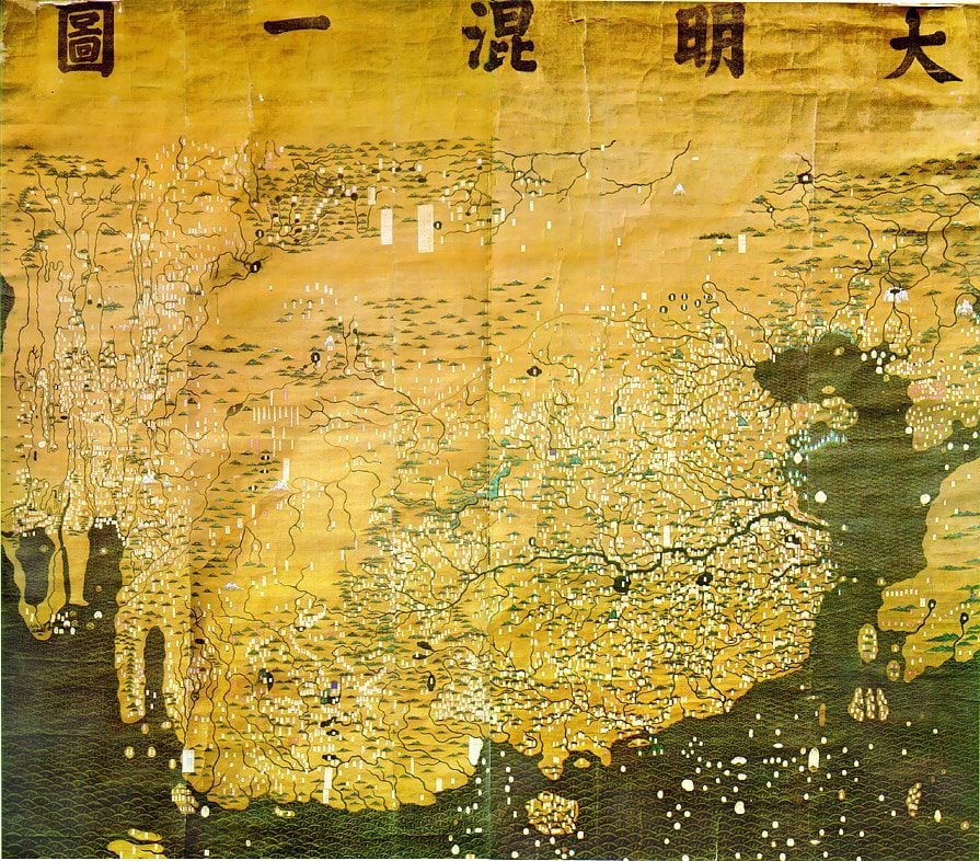
The Da Ming Hu Yi Tu, a Chinese map made in the late 14th century.
This map shows the world as it appeared to China during the Ming Dynasty, with China dominating the overwhelming majority of the planet and all of Europe squeezed into a small space in the west.

The Kangnido World Map, created by Korean officials in 1402 AD.
This map, created by the Joseon Dynasty, combined Chinese maps with information about the Western world, gathered from Mongolian Muslims.
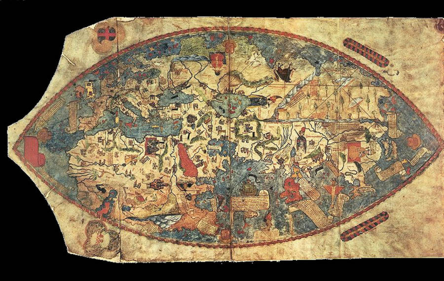
The Genoese map, drawn in 1457 based on the descriptions of Niccolo da Conti.
This map depicts a growing European understanding of the Asian world after the first trade routes with Mongolia and China opened.
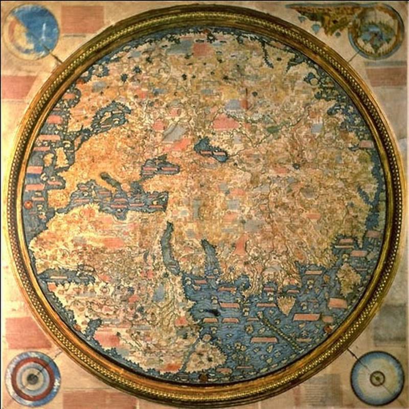
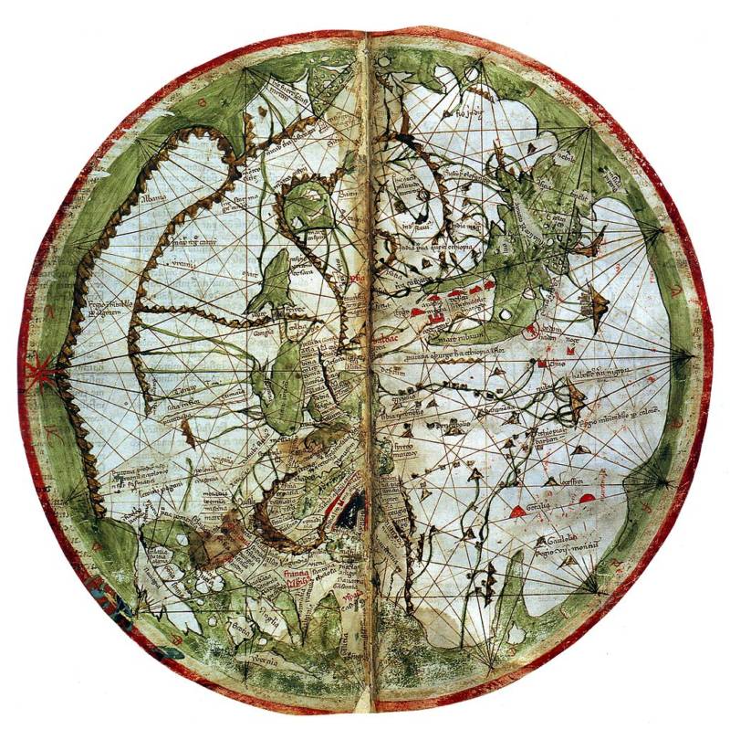
A map made by Venetian monk Fra Mauro between 1457 and 1459.
This map was made with the help of Andrea Bianco, a sailor and cartographer, and reflects his extensive knowledge of the world.
The Mer des Hystoires world map, drawn in 1491.
Even during the age of exploration, some monks continued to make T and O maps, with Jerusalem at the center of the world and paradise as a real location in the eastern side of the world.

A projection of the Edapfel globe, produced by Martin Behaim in Germany in 1492.
The Edapfel is the oldest known globe, showing the world as a sphere but with the undiscovered America as an empty ocean.
Johannes Ruysch's map of the world, drawn in 1507.
This map shows one of the first drawings of the New World.
Martin Waldseemüller and Matthias Ringmann's map, drawn in 1507.
This was the first map to label the New World as "America," drawn, here, as nothing more than the thin strip of the eastern coast.

Gerard van Schagen's map of the world, drawn in 1689. By now, much of the world had been mapped, with only small parts of the Americas left ambiguously blank.

Samuel Dunn's map of the world, drawn in 1794 AD.
Using the discoveries of Captain James Cook as his guide, Dunn was able to outline the whole world for the first time.
29 Ancient Maps That Show How Our Ancestors Saw The World
Enough news articles 29 Ancient Maps That Show How Our Ancestors Saw The World this time, hopefully can benefit for you all. Well, see you in other article postings.
29 Ancient Maps That Show How Our Ancestors Saw The World
You are now reading the article 29 Ancient Maps That Show How Our Ancestors Saw The World with the link address https://randomfindtruth.blogspot.com/2018/08/29-ancient-maps-that-show-how-our.html